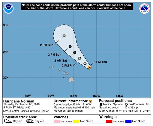
Hurricane Norman passed well to the east of the Big Island earlier today, bringing high surf to east-facing shores and some welcome tropical breezes, but little else.
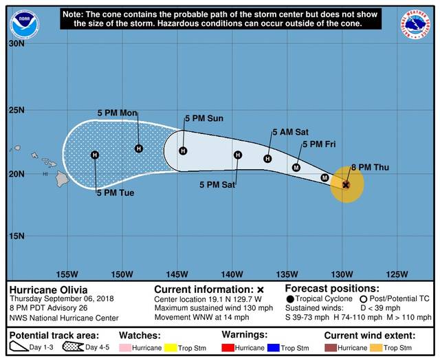
In the meantime Hurricane Olivia has strengthened in the Eastern Pacific to a Category 4 storm, and although the tropical cyclone is still closer to Mexico than Hawaii, longer-range computer projections show it either making land or coming close to the Big Island as a hurricane either late Tuesday night or early Wednesday morning.
“The farther a hurricane is away, the more difficult it is to accurately project its track or intensity,” said Vanessa Almanza, a National Weather Service meteorologist in Honolulu.
As of 5 p.m., the center of Olivia was 1,635 miles east of Hilo, and the storm was packing maximum sustained winds of about 130 mph with higher gusts.
Hurricane-force winds extend outward up to 30 miles from the storm’s center and tropical-storm-force winds extend outward up to 115 miles from the center.
Forecasters at the National Hurricane Center in Miami said some fluctuations in intensity are likely on Friday, but gradual weakening should start soon.
Olivia is moving to the west-northwest at about 15 mph and this motion is expected to continue through Saturday. However, a gradual turn toward the west is expected Saturday night or Sunday that could put the Big Island in harm’s way.
“We’re well into hurricane season and people should be prepared by now,” Almanza said.
Recommended items for a survival kit can be found on the American Red Cross website at www.redcross.org/get-help/how-to-prepare-for-emergencies/survival-kit-supplies.
Norman, meanwhile, continued to weaken as it passed 295 miles east-northeast of Hilo as of 5 p.m.. The Category 2 storm had maximum sustained winds of 100 mph.
A high surf warning remains in effect until 6 a.m. Friday for east-facing shores of all major Hawaiian islands, and surf from Norman is forecast to gradually decrease on Friday, as well.
Email John Burnett at jburnett@hawaiitribune-herald.com.


